Shoreward Migrating Sandbars
Without question, the single most effective action to be taken to stave the erosion problem at both Salisbury & Plum Island beaches is to repair the landward end of both River Mouth Jetties where wave action has tumbled the granite stones into the river. To best prepare both shores for future sea level rise, a redesign of these structures also needs to be considered. To understand this position, let’s examine the function of the River Jetties.
When the Jetties were 1st constructed, shallow sandbars and shipping were primary concerns. Much like attaching a nozzle to a garden hose, the objective was to narrow the width of the river channel thereby increasing river current velocity. This increase in flow was to scour the river bed of sand keeping the channel deep for shipping purposes. However, the river bed never remained deep enough, as coastal processes kept refilling the channel with sand. Hence the Jetties were extended in length a number of times to prolong the duration of increased current velocity, driving that "nuisance sand" out to sea, and to keep sand from spilling into the channel from the shores of the barrier islands. The net effect of Jetty construction however, was that the river delta bar & its sand supply, which was once near shore & fused with area beaches, was relocated far off shore. As a side effect, the South Jetty began to act like a giant beach groin collecting sand along its south side widening & increasing the height of Plum Island. Ultimately, nature prevailed, the channel never remained shallow enough & a dredging program was implemented.
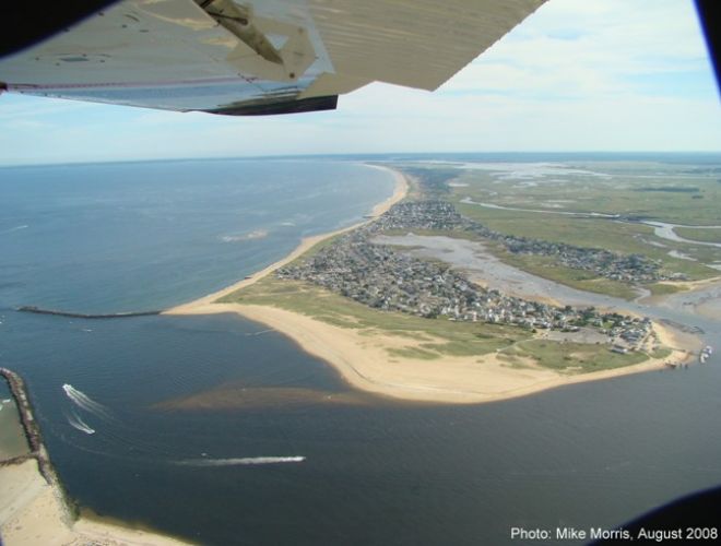
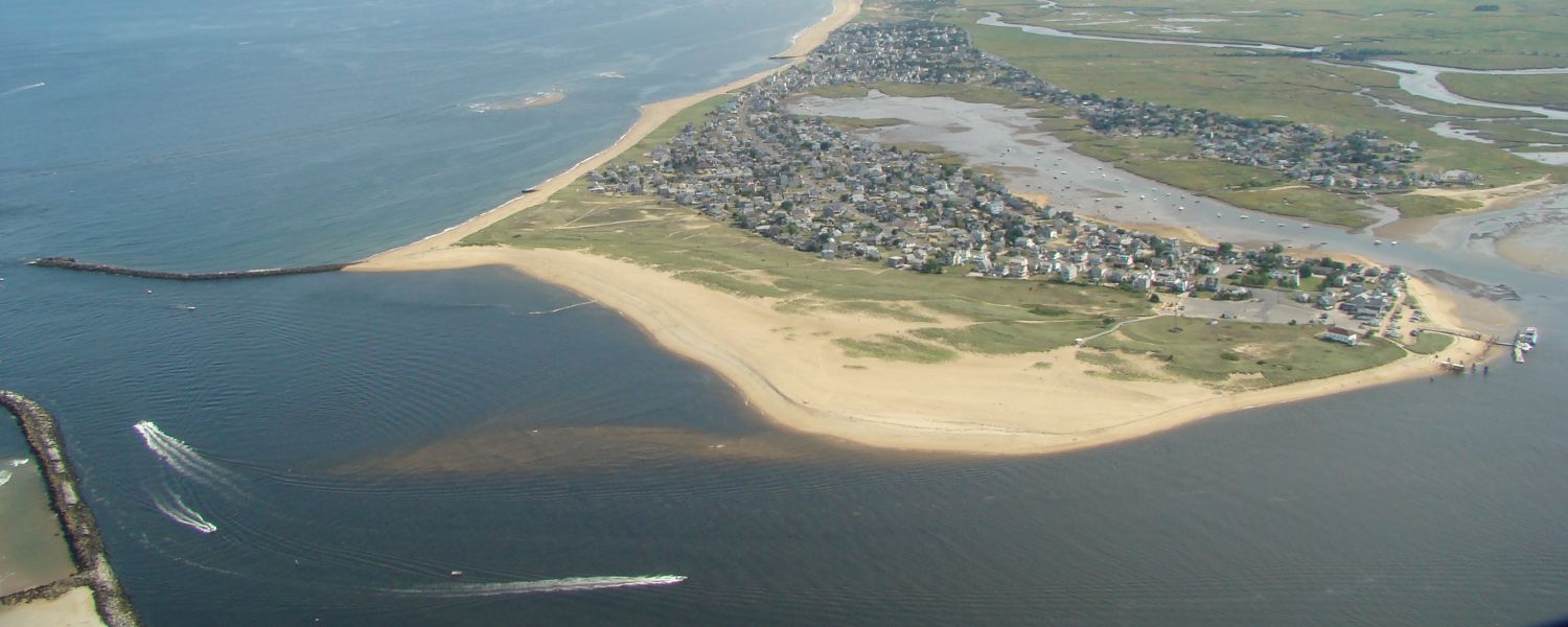
Though they were built as navigation structures, we see that the River Jetties actually serve a second function that directly impacts neighboring shores – gathering sand on the beach side & keeping it out of the river channel. So, relative to the barrier islands they also behave as what are known as Terminal Groins. As Terminal Groins, the Jetties bracket both shores, halting sand migration into the river, thereby keeping portions of the beaches near the river mouth stable. When low spots (or wave induced breaches) do form in the Jetties close to shore, nature’s cycles quickly resume and wave action efficiently passes sand from both the Plum Island & Salisbury beaches into the river. The result is a narrowing of the shoreline. Today, the most significant low spot or breach in the Jetty lies close to shore on Plum Island where it dictates a new high water mark, narrowing the overall shore, encroaching upon existing homes. Sand can only build up (widening the shore) to the point of the Jetty breach. Any wider and wave action simply passes the sand through the breach into the river- ultimately expanding Plum Island Point. This isn't just a storm wave event, but a 24 hour a day sand migration that is part of a spit building process that nature seeks to continue. Plum Island Point is a continuously expanding Sand Spit that the Jetty (when it's intact) serves to interrupt.
Looking back into history, when the South Jetty was first constructed on Plum Island, this spit building process quickly stacked sand up behind the Jetty along the ocean facing shore increasing both the width & height of the barrier island - all the way back to the National Wildlife Refuge. The effect is much like a highway accident where cars driving north encounter an incident & then, as they collect, traffic backs up far to the south. This newly formed piece of real estate promptly filled with houses - where water once was. Now their existence is tied to the integrity of the South Jetty. When the Jetty fails, coastal processes drive sand back into the river, the shore narrows & houses are in jeopardy.